The Ottomans preserved Edirne’s pre-existing urban plan and used it as the Ottoman’s city center. The focal points and landmarks that had been a part of the city’s public memory were maintained and new structures were purposefully positioned favoring historical continuity. Edirne has been formed by the transmission of multiple cultures and its morphology has… View Article
The Ottomans preserved Edirne’s pre-existing urban plan and used it as the Ottoman’s city center. The focal points and landmarks that had been a part of the city’s public memory were maintained and new structures were purposefully positioned favoring historical continuity. Edirne has been formed by the transmission of multiple cultures and its morphology has found meaning in this richness.
The ‘street’ is one of the core elements of urban layout and is a vital space where urban events take place beyond its mere transportation function. In this respect, the ‘street’ is the “organizing axis” in urban configuration. The perspectives of the Ottoman streets and squares form spatial richness. The Ottoman streets create surprising spatial compositions in both the second and third dimensions.
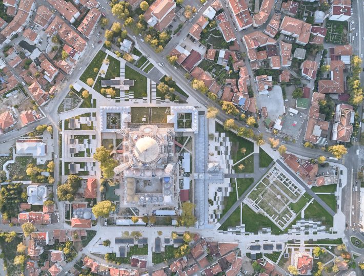
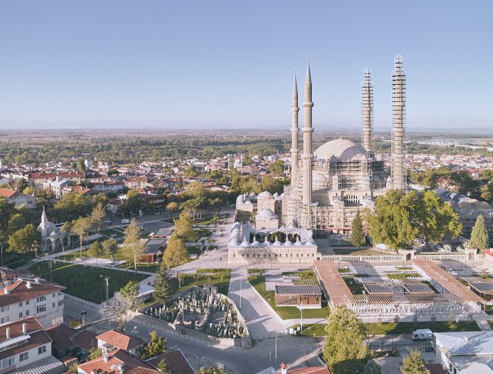
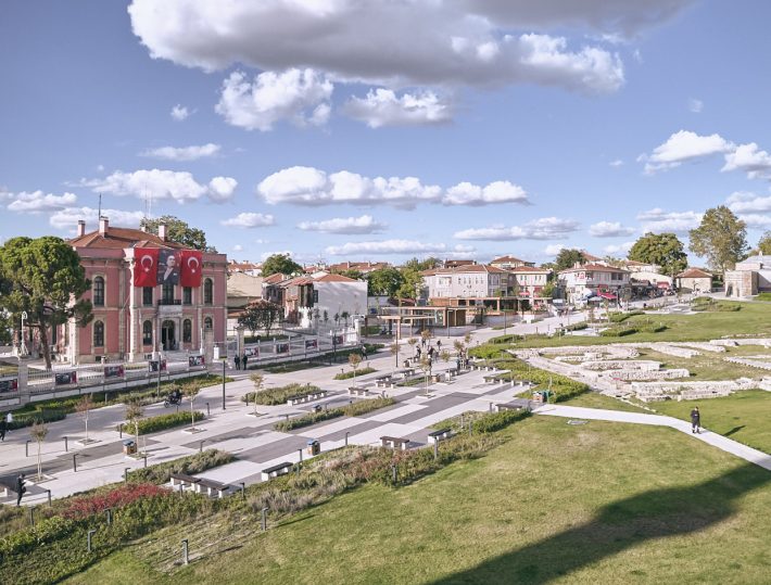
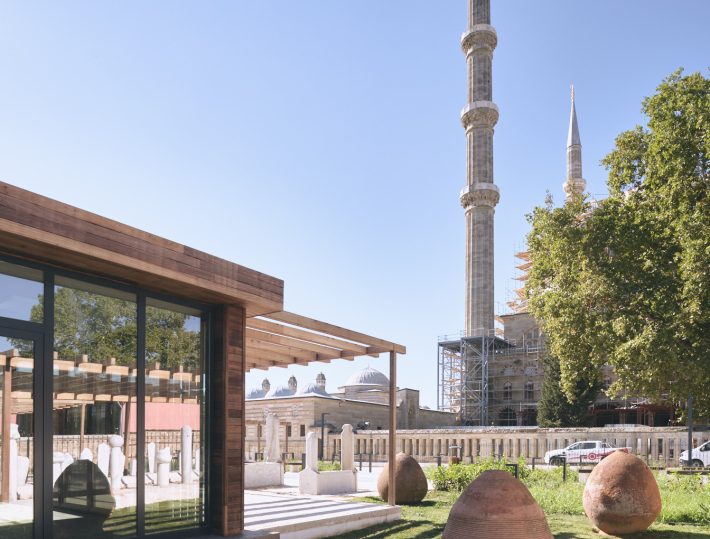
Selimiye, which was perceived through the shops, markets, high-walled enclosures, narrow streets, and squares, had become increasingly isolated over the years and disconnected from its original perception due to the policy of “removal of old structures” in front of mosques and as a result of natural disasters. The spatial composition formed by the pre-existing commercial structures and semi-open marketplaces around Selimiye is highly valuable.
However, reconstructing the historical Ottoman buildings around Selimiye in an attempt to restore its historical perception is not a sound solution, since this would be nothing more than a replica and a fictitious formation. The Project respectfully achieves to restore the aforementioned valuable perception by preserving and rebuilding the historical axes. The topography around these historical axes is raised through gentle slopes in order to emphasize them, and a plain landscape pattern is created above them. This allows it to guide the perception of Selimiye without interrupting its continuity. The intersections of these axes are enriched with urban functions and create an urban space where people can gather and spend time. The square, formed through the intersection of the streets and historically provided with a fountain, hosts semi-open spaces where people can meet and where events can be held. In this cinevision room, tourists can access installations and video images about Edirne and Selimiye, and workshops where products of Edirne’s culture can be manufactured and exhibited (a fruit soap workshop, a broom workshop, a woodworking workshop, a paper marbling workshop, a sculpting workshop). As an Ottoman capital and palatial city, Edirne has historically developed a culture of handcrafting and high-quality artistic creation. The handicraft workshops as well as other arts are a reflection of Edirne’s history and culture and spread homogeneously throughout the Project area.
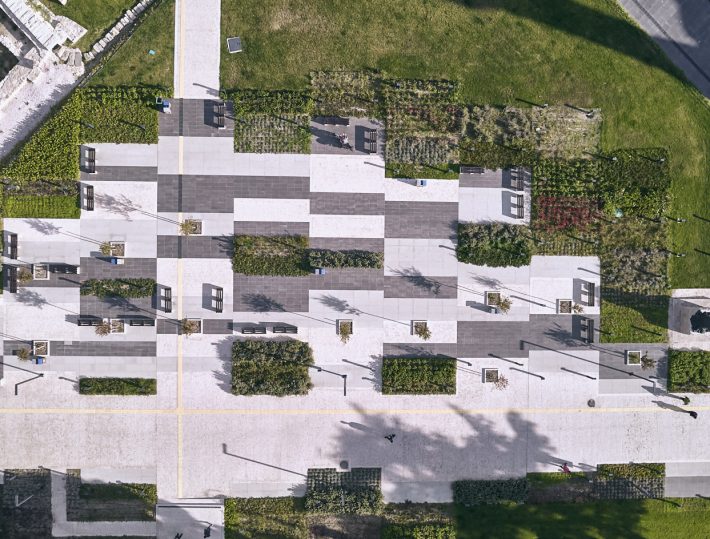
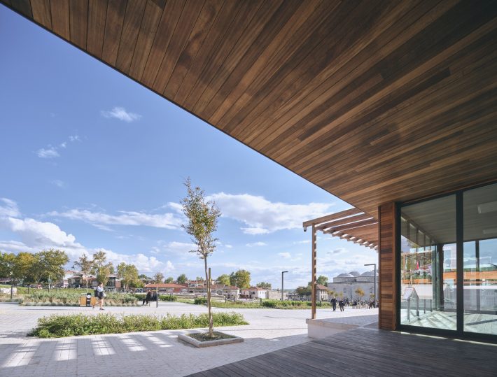
In the Project, the landscape setting is strengthened by the use of architectural elements. The form and scale of the architectural elements are determined by the historical axes and the hierarchical urban layout.
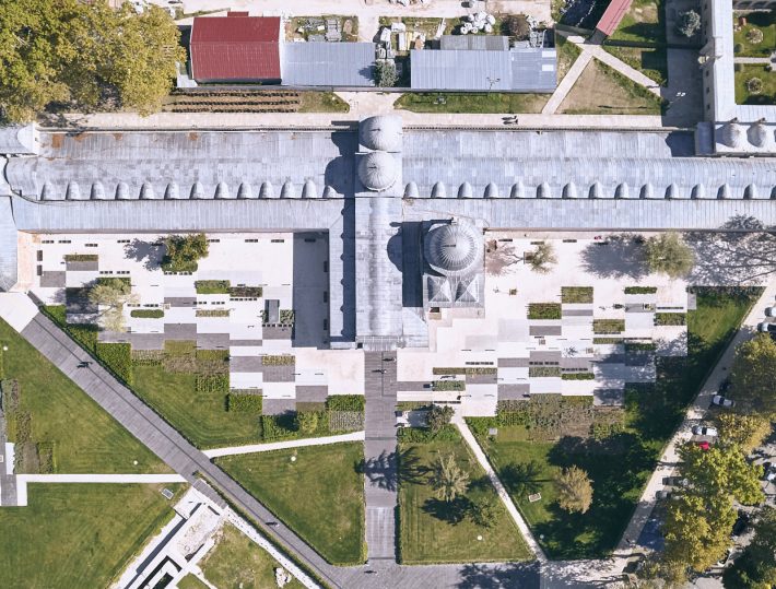
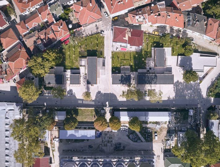
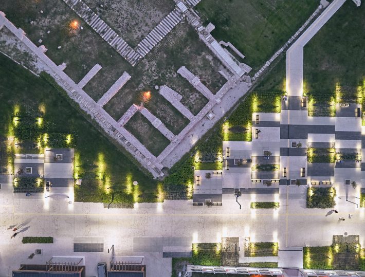
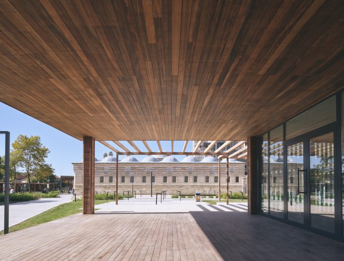
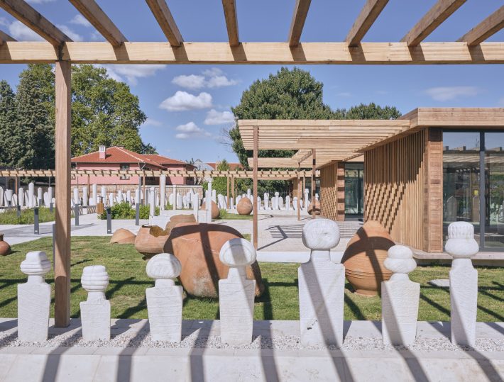
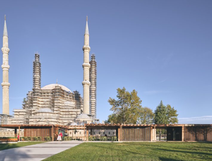
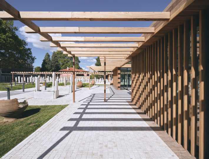
The historical axes to be revitalized are revealed with modules with a permeable typology. The permeable modules support the continuity of the urban circulation emphasizing the connection to the main Street, which takes the pedestrian to Selimiye’s entrance. The buildings’ materials are wood and glass, and the canopies along the urban corridor are also made of wood. These wooden modules take their geometry from the geometry of the historical buildings around them. Following the logic of the Ottoman urban layout, the design respects and co-exists with the pre-existing setup.
Since the orientation of the historical walk paths is aligned with the current urban layout, pedestrians still tend to move through the same axes even if the paths have disappeared. For instance, the axis of Bedesten (Ottoman market hall) used to be aligned with the gates of Iki Kapılı Han and transfer people to Caravanserai (Ottoman urban hotel). Still today, people move in the same direction through the park located where İki Kapılı Han used to be. Although those traces of Edirne have been destroyed over the years, their flow continues to exist. In this context, the Project revitalizes the historical traces around Selimiye and helps lead pedestrians to the different landmarks of the city.
The Project does not favor vertical circulation when approaching Selimiye through the historical axes. The reason for this is precisely to make the pedestrian feel and relive the old perspectives and perceptions, walking through the historical corridors, and to provide the right composition within the urban layout.
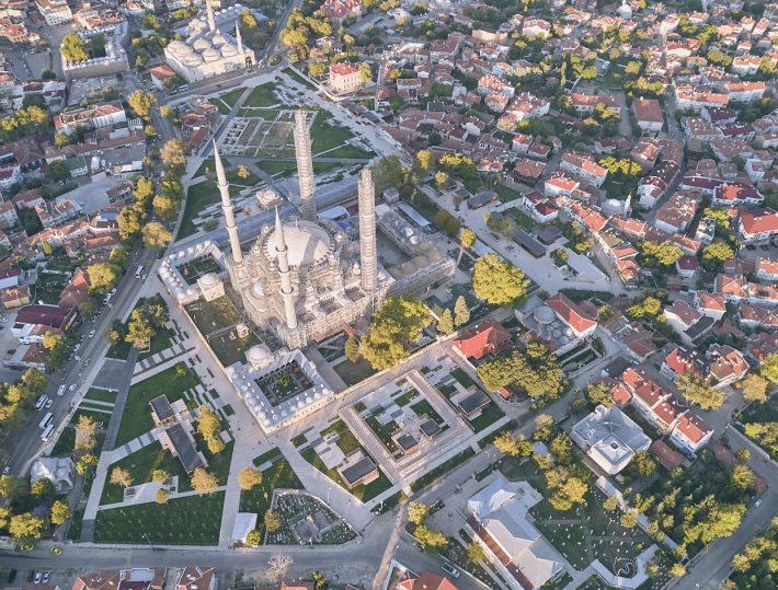
The axis in front of Edirne Municipality (Mimar Sinan Street) is also reinforced with functions and canopies. Canopy structures extend both to the pathways and to the courtyards behind them and promote urban life. By revitalizing the street, this important axis will again find its place in the urban layout.
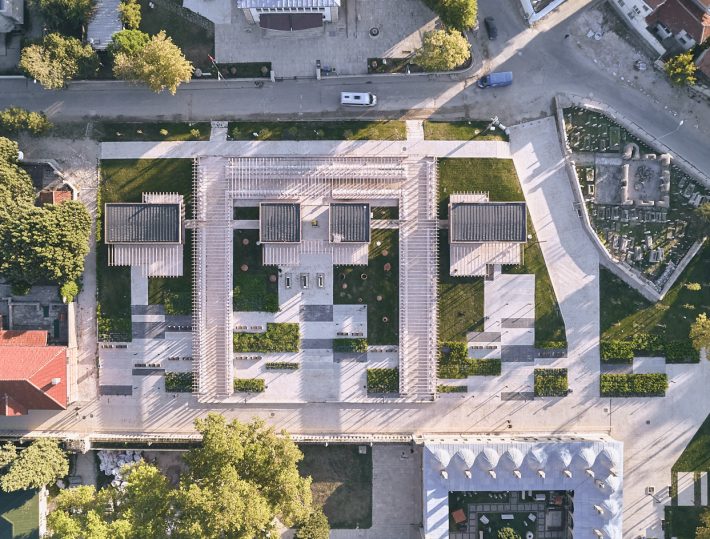
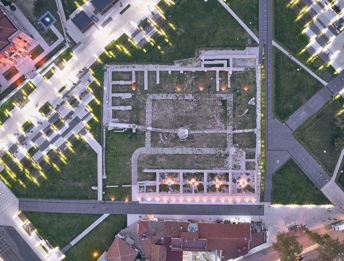
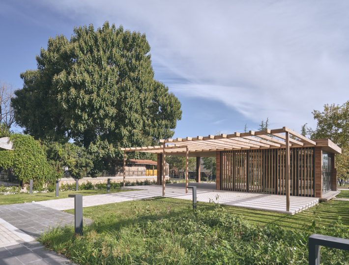
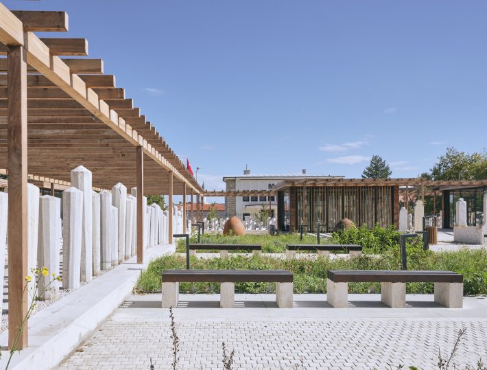
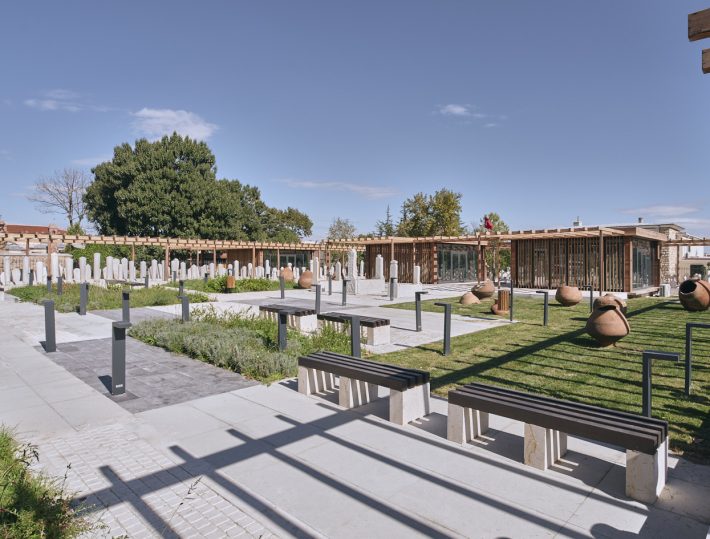
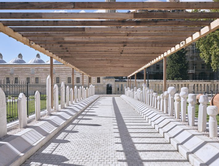
In the Project, the Ottoman tombstones exhibition area, which was passive and idled in the northeast of Selimiye, is brought again into urban life and enriched with functions and semi-open canopies. This naive semi-open canopy retreats back from Selimiye and creates a courtyard in between. Ottoman tombstones are exhibited in this courtyard in a circular exhibition space. In terms of functions, there is a tombstone crafting workshop, a modern sculpture workshop, and two cafes. Therefore, the “backyard” of Selimiye is enriched and connected with public spaces within the city.
The archaeological excavation area of Yemiş Kapanı Han is included in the Project’s landscape design and re-engaged with urban life. Two main gates of Yemiş Kapanı Han were revealed from historical data, on opposite sides of the building, creating an axis of circulation that the Project restores through landscape design. The landscape elements and the lighting guide the circulation of pedestrians and make the occupancy-void (building-courtyard) ratios of Yemiş Kapanı Han legible. The historical heritage is transmitted to new generations while walking through the archaeological site, connecting them with the area’s history.
The Ottomans respected the Byzantine urban layout and settled in the city following the pre-existing structure. The Project achieves to revitalize the historical setup and re-engage it with today’s urban setting.